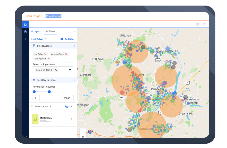
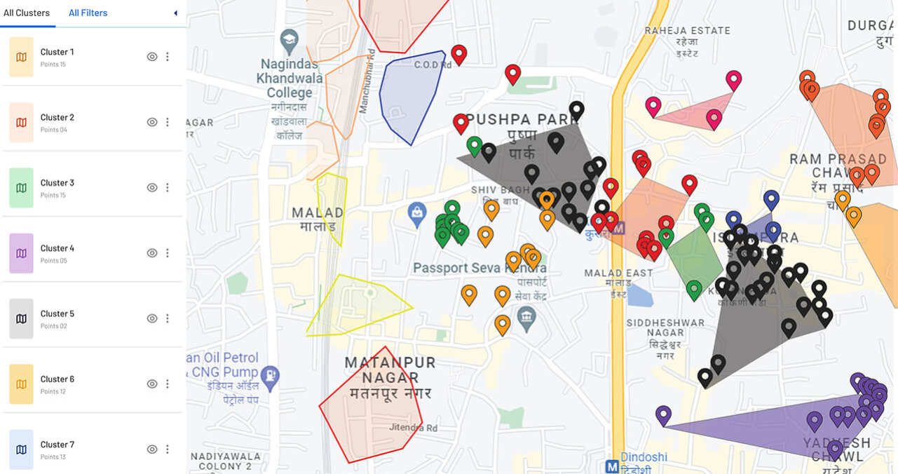
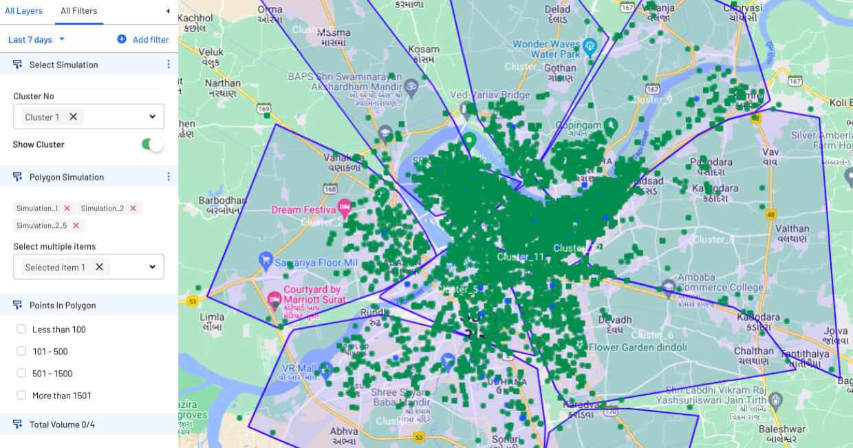
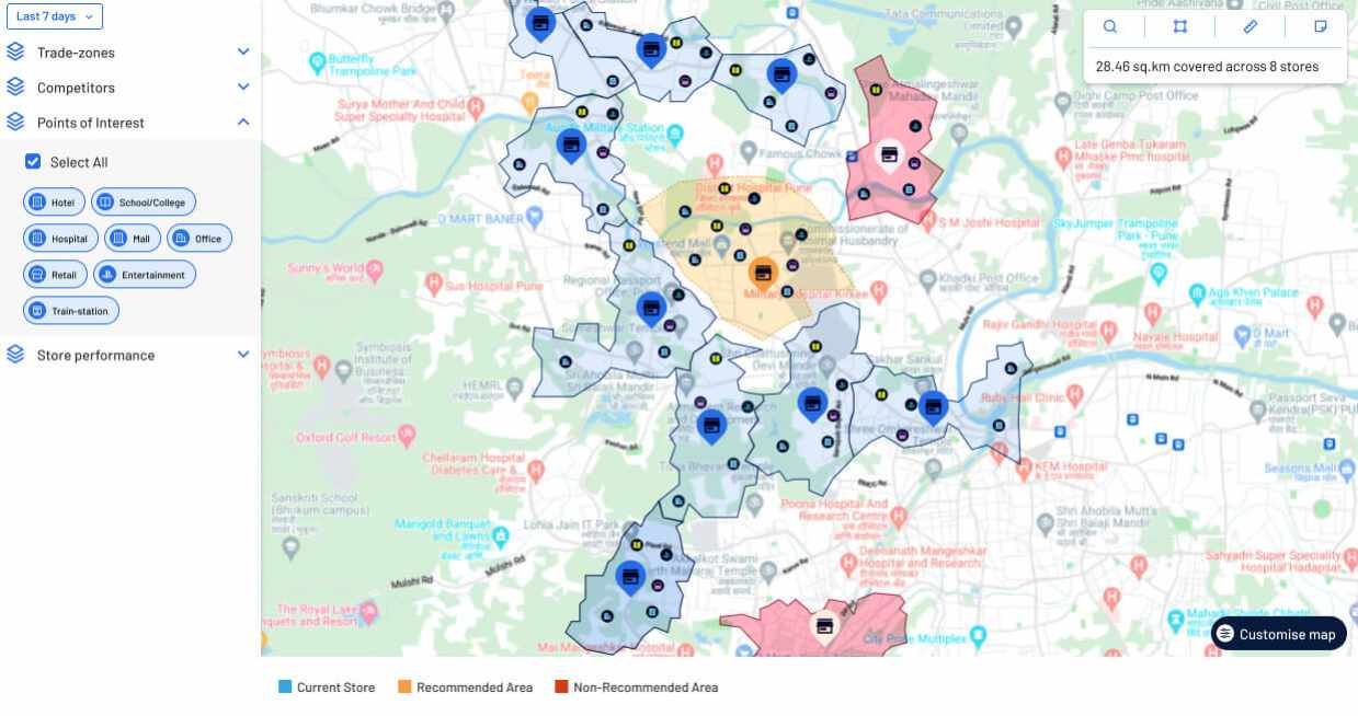
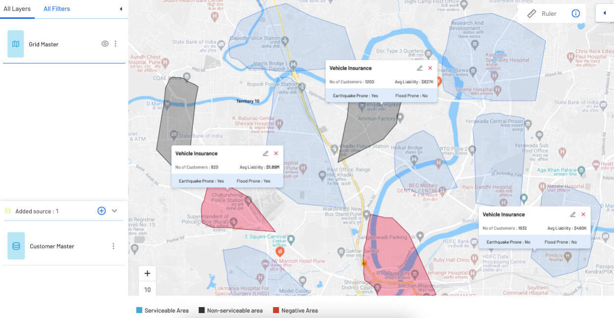
Trusted By Leading Brands


Gain Strategic Advantage with Advanced Geospatial Analytics
Deeper Visualization
Improve Foresight and Prediction
Enhance Operational Efficiency
Improve Strategic Decision Making
Uncover Growth Opportunities
Customize Offerings
Leverage Location Intelligence to Transform Sales
Visualize
Strategize
Operationalize
Features
Outlier Detection
Cleanse your location data, remove inaccuracies, and duplicate records. Segment territories with precision, detect outliers, create clustering grids and plan smarter business outcomes.
Clustering Analysis
Run clustering algorithms to identify and define patterns based on revenue, prospect location density, sales rep proximity, and more. Prioritize high potential leads.
Polygon Mapping
Visualize and analyze location data points and perform gap analysis. Set custom clustering rules to define multiple datasets and create location grids.
Interactive Heatmaps
Create, categorize, and organize your data with interactive heatmaps for better visualization. Use point and line density, color codes to identify key pockets on maps for deeper visibility.
POD Analysis
Dive deeper into polygon maps for an in-depth analysis of all areas in a given location. Get intuitive map visualizations and real-time visibility to enable faster and smarter business decisions.
Data Visualization
Create interactive and compelling data visualizations. Define and refine maps based on business requirements. Draw contextual insights using data filters and get drilled-down analysis.
Trends and Patterns
Unlock key trends by running multiple simulations and get intelligent insights. Uncover hidden patterns with AI/ML-based spatial analysis to discover new information from large datasets and make smarter decisions.
Data Layer Management
Overlay multiple data points and derive meaningful outcomes. Pair various attributes of data points with location to get deeper insights.
Use Cases
Business Expansion
Dista’s geospatial analytics software runs several simulations on your location data to identify potential markets for business expansion. It helps spot gaps in your coverage area and overlay Google Maps-based points of interest (POIs), competition, and census data to highlight potential areas for expansion.
Territory Management
Use advanced mapping and reporting tools to ingest, analyze, and visualize data related to your customer locations, sales territories, agent mapping, POI data, and others. Identify new market opportunities and track customer dynamics to gain a competitive advantage.
Performance Analysis
By utilizing location-based data, our geospatial data software allows companies to uncover patterns, draw correlations, and make decisions that support their business objectives. This helps them accurately assess their products and services’ performance and identify growth areas.
Industries
Banking and Finance

Insurance

Logistics

CPG & Retail

Food and Beverage
