
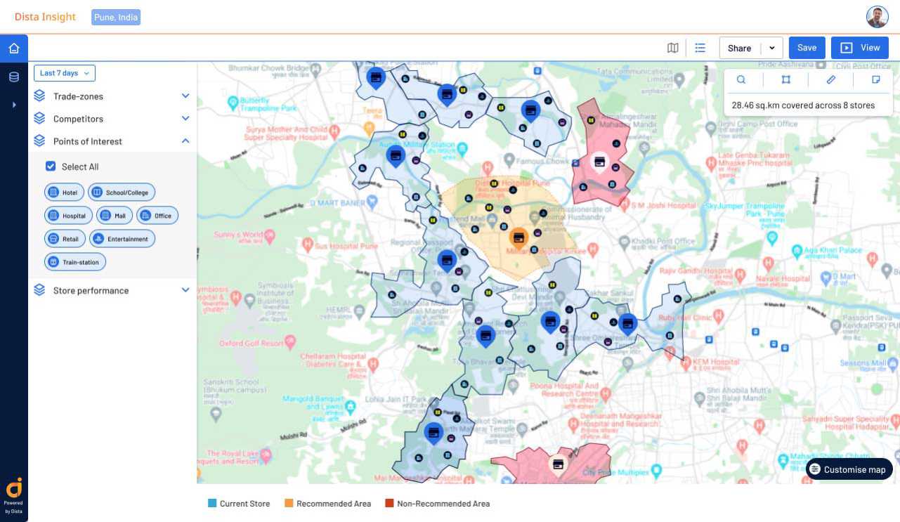
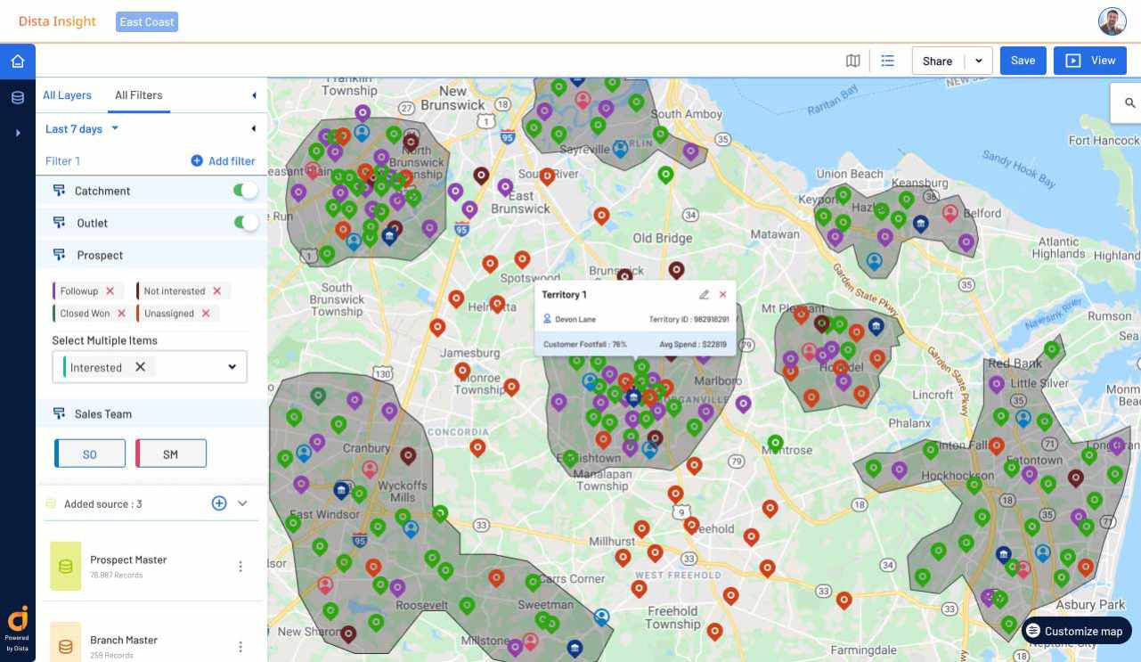
[Case Study] Consumer Packaged Goods Major Improves Sales Territory Planning with Dista Insight
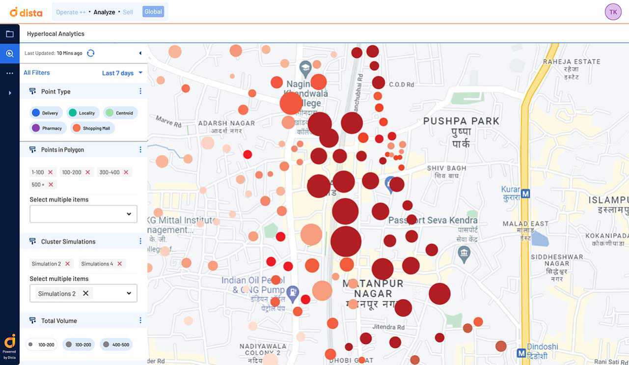
[Case Study] E-Commerce Platform Leverages Dista Insight to Improve Supply Chain Network Design
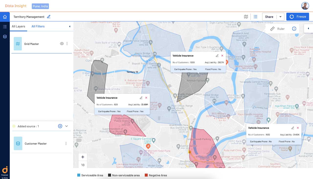
[Case Study] Major Insurtech Firm Leverages Dista for Effective Automotive Inspection Process
Top Benefits of Geographic Information Systems (GIS)

How Dista Optimizes Supply Chain Network Planning with Spatial Analytics