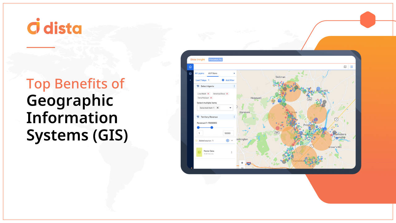
95% of executives believe geospatial insights are necessary to achieve the desired business results, says a BCG study. Enterprises leverage Geographic Information Systems (GIS) software to strengthen their strategic decision making process.
A robust GIS mapping software captures, visualizes, and analyzes geographic information and showcases it on a map to derive insights, patterns, and trends.
Let us learn more about the role of GIS and its key benefits in this blog.
Also Read: Top GIS Trends for 2024
What is GIS?
A GIS is a tool for capturing and analyzing geospatial data. It enables enterprises to visualize multiple data layers on a map and derive trends and patterns.
Key Benefits of GIS
Let’s deep dive into the top benefits of GIS and how leveraging robust GIS software helps enterprises streamline business processes.
1. Strengthen Strategic Decisioning
With intuitive map-based visualization of geospatial data, a GIS system helps business leaders analyze their geospatial and business data for easier and speedier decision-making. Businesses can derive meaningful trends and patterns by leveraging the data to improve their business expansion plans. GIS also assists governments with zone planning, urban planning, conserving natural resources, and protecting the environment, among other things.
Read More: 7 Ways GIS can Improve Your Business
2. Improve Marketing and Promotions
GIS empowers business leaders with geospatial insights derived from location and business data for a particular region. Business leaders can leverage these insights to carve marketing strategies and personalized location-based customer campaigns.
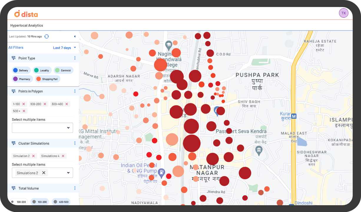
3. Visualize Business Data on Maps
With GIS tools, organizations can get a bird’s eye view of key location and business data points on a map for complete visibility. This helps businesses visualize key data points like competition, customer coverage, gaps, new market and opportunities to strengthen their business decisions.
4. Record Geographical Data
GIS helps maintain crucial geographical data and records about the old and new changes in different regions. Several firms are responsible for geographical accounting and tracking cultural geographies like population census, land ownership, and administrative boundaries. Other examples include forest and biological inventories, environmental measurements, agriculture applications, and more. Government organizations can also use mapping applications to engage with communities and improve policymaking.
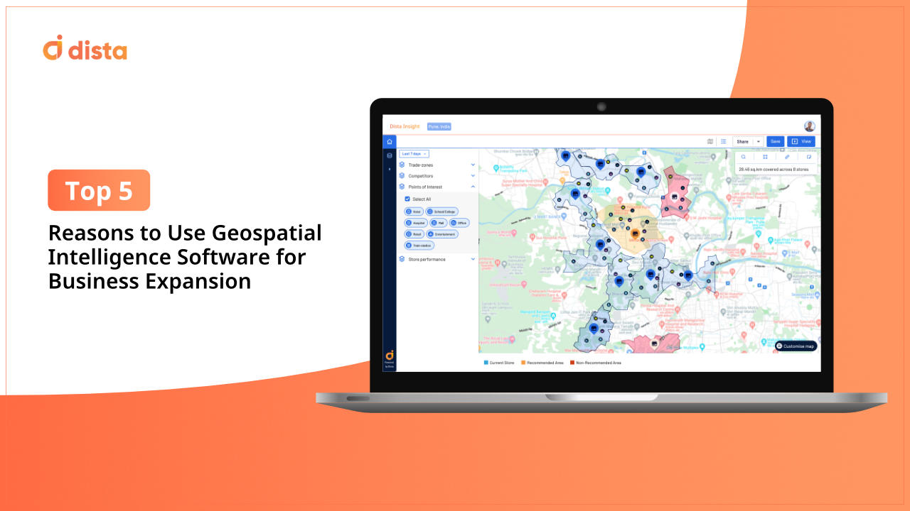
5. Plan Market Expansion
GIS platforms like Dista enable sales and strategy leaders to plan for business expansion. Strategically leveraging several points of interest (PoI) variables, such as population density, income index, socio-demographic profile, consumer buying behavior, competition reach, etc., and pairing these data points with existing business variables gives a new dimension to expansion plans.
GIS platforms like Dista give business leaders visibility into new, untapped markets. They are also instrumental in optimizing their existing business reach. For example, sales leaders get a clear map-based visual perspective on the number of stores or branches in a specific geography. Leaders can easily identify underserved and overserved geographies, resulting in overhauling their business reach.
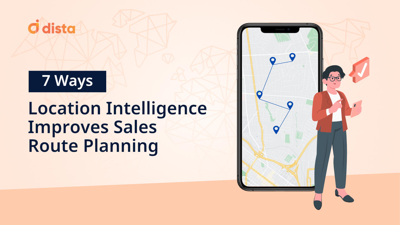
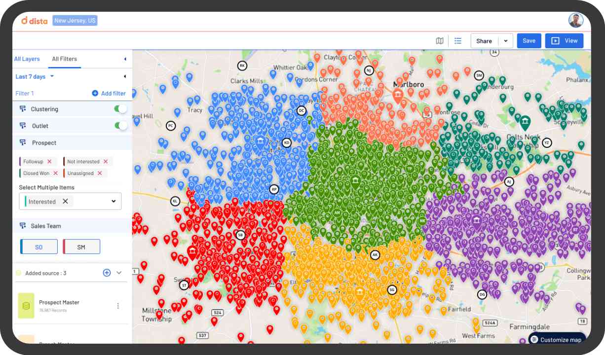
6. Balance Sales Territories
Designing balanced and equitable sales territories maximizes sales coverage, reduces the number of routes for sales reps to travel, decreases the distance traveled, and saves fuel costs and time. GIS platforms like Dista offer sales leaders the ability to design, refine, and realign sales territories, enabling them to expand their sales coverage.
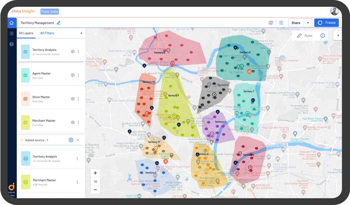
Balanced sales territories also streamline lead allocation and lead distribution. Balanced territory planning optimizes sales workload, reduces lead leakage, ensures high prospect engagement, and increases conversion rates. With Dista’s unique area clustering algorithm, sales leaders can run multiple simulations to identify the most optimal territory plan based on their business needs. Moreover, balanced territory plans lead to optimized scheduling and route plans, resulting in more prospect meetings.
7. Reduce Operational Cost
By balancing sales workloads, GIS software platforms can optimize sales resources. Sales leaders have clarity on rep allocation to a specific geography, resulting in a reduction in over-hiring. GIS systems offer address geocoding and verification that help standardize addresses of leads, customers, branches, stores, distribution centers, warehouses and more. Standardization of addresses helps in reducing travel time for sales reps traveling to prospect locations for meetings. It also allows service technicians to schedule and plan optimized routes for service requests. Moreover, orders are made on time and faster with accurate delivery locations.
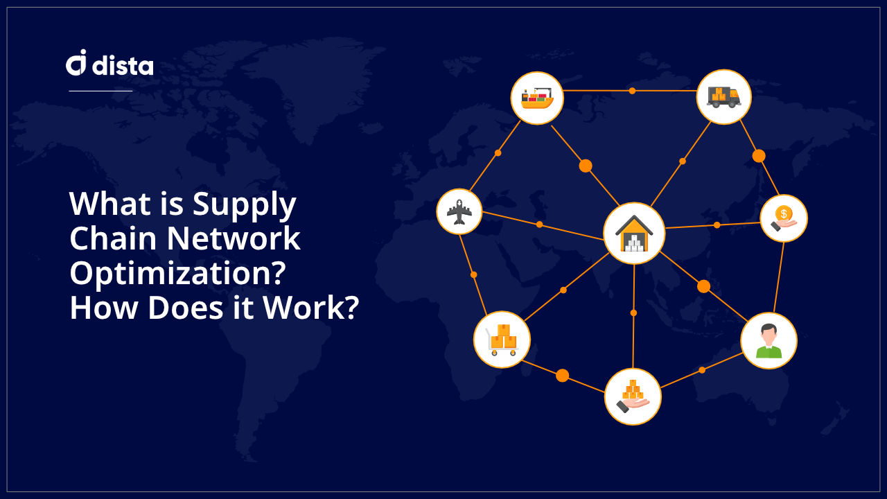
GIS platforms equip logistics and supply chain leaders with a visual layout of their current supply chain and offer actionable insights on optimizing it by finding suitable locations to set up new warehouses or distribution centers. GIS software like Dista optimizes supply chain network design by overlaying geospatial analysis on existing business data and significantly reducing operational and logistics costs.
Final Thoughts
GIS tools will continue addressing multiple use cases across industries and empower organizations to strengthen their business expansion strategies. Business leaders need to invest in robust geospatial analytics software to streamline their business operations and improve customer experience.
If you want to empower your teams with the right GIS software, Dista is the perfect fit for you. Get in touch with us to see our platform in action.